
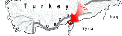
The area under investigation
is located in SE-Turkey, Villayet Hatay (along the Gulf of Iskenderun),
at the Western Slopes of the Amanos Mtn. (Nur
Daǵları) between
36° 15´ 00´´ and 36° 22´ 30´´
of eastern longitude and 36° 48´ and 36° 52´ northern
latitude, with its unique ![]() Beautiful
Mountain Landscapes. Above
the town of Dörtyol the research area extends from the middle colline
belt (250m a.s.l.) to the sub-alpine peaks of the 'Daz Daǵları'
( Harmankaya Tepe 2.208m a.s.l.). Background information regarding Nature-Protection
and Landscape-Development-Programs in Turkey, cf. World Conservation Monitoring
Centre. Overviews of the research area are offered as Satellite-images:
Beautiful
Mountain Landscapes. Above
the town of Dörtyol the research area extends from the middle colline
belt (250m a.s.l.) to the sub-alpine peaks of the 'Daz Daǵları'
( Harmankaya Tepe 2.208m a.s.l.). Background information regarding Nature-Protection
and Landscape-Development-Programs in Turkey, cf. World Conservation Monitoring
Centre. Overviews of the research area are offered as Satellite-images:
![]() The
Amanos Mtn. with the Gulf of Iskenderun
The
Amanos Mtn. with the Gulf of Iskenderun
![]() The
research area between Dörtyol and the Daǵları peaks
The
research area between Dörtyol and the Daǵları peaks
(e.g. names of turkish villages, mountains) 'Turkish Fonts for Windows' are necessary.
- Ecosystem Research & Vegetation Science
- Soil Science
- Bioclimatology
- Erosion Research
- Remote Sensing
- Berlin Technical University (TUB)
- German Research Foundation (DFG)
- German Society for Technical Cooperation (GTZ)
- Donors Association for the Promotion of Sciences and Humanities
- Adana University of Cukurova - Turkey
- Assoc. Prof. Dr. Harald Kehl (CV, Publications and Research Interests)
- BOOK (2 Vol. with 657 pp, 106 Figs., 75 Tables, 39 Photos, incl. 6 comprehensive tables with Vegetation Units as a result of the synoptical classification and a set of 8 Thematical Ecological Maps) and alternatively on
- CD-ROM
-
 -Files, cf. Publications
©
Harald Kehl
All rights reserved
Formerly TU-Berlin · Fac. VI · Institute of Ecology
Last updated on
23.06.2021