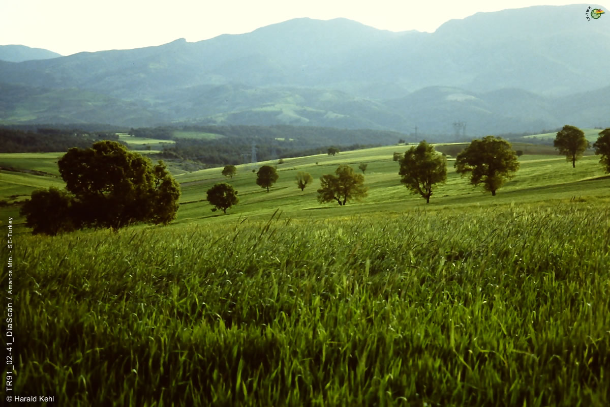
AM-04
 
C6-16
Landscapes and Habitats of the Amanos Mtn. above Dörtyol (SE-Turkey, Hatay Province)
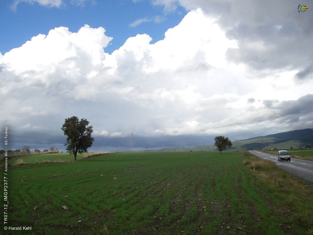
recorded
in the Framework of the Mountain Ecology Research ProjectLöKAT

(TU-Berlin, Inst. f. Ökologie, 1988-1997)
Compilation provided 2017 by Assoc. Prof. Dr. Harald Kehl
sEp
     
  List of Plant Species in the LöKAT data base
List of Plant Families in the LöKAT data base
Additional List of Plant Species - Lecture LV-TWK
 
TEMaps (large PDF/JPEG-Files) of the Research Project  
   
Landscapes etc. above Dörtyol (SE-Turkey, Hatay, Amanos Mtns. / Amanos or Nur Daǵları)
       
   
Fig. C6-16/01:
Location of the Research Area in SE-Turkey and detailed information on the LöKAT Research Project.
 
 
Altitude (a.s.l.):  
---  
   
  Remarks:
  maps-for-free.com. Visit the LöKAT Website for detailed information on the LöKAT Research Project in SE-Turkey (Hatay, Amanos Mtns. or - turkish - Nur Daǵları).
Click the Thumbnail
     
     
Satellite Images:    
Fig. C6-16/02:
Satellite Image of the Amanos Mtns. with the location of the Research Area above Dörtyol.
 
 
Altitude (a.s.l.):  
0 - 2.262m  
   
  Remarks:
Landsat 5 TM, proc. by J.M. Grunicke & R.R. Hildebrandt, FU-Berlin, Germany (700x1.120 Pix., 287KB).

Click the Thumbnail
Fig. C6-16/03:
Satellite image of the LöKAT project area above Dörtyol and the Daz Daǵları with Yaylas and important Research Points.
 
 
Altitude (a.s.l.):  
250 - 2.208m  
   
  Remarks:
Landsat 5 TM, from Nov. 1989, proc. by J.M. Grunicke & R.R. Hildebrandt, FU-Berlin, Germany (700x1.120 Pix., 237KB).

Click the Thumbnail
 
 
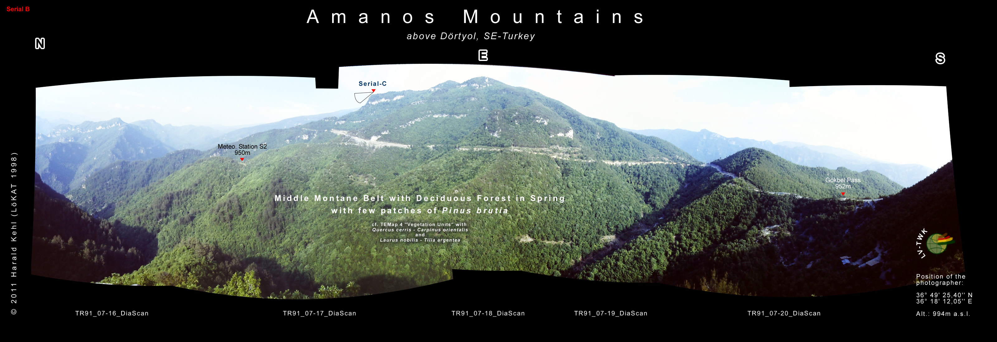
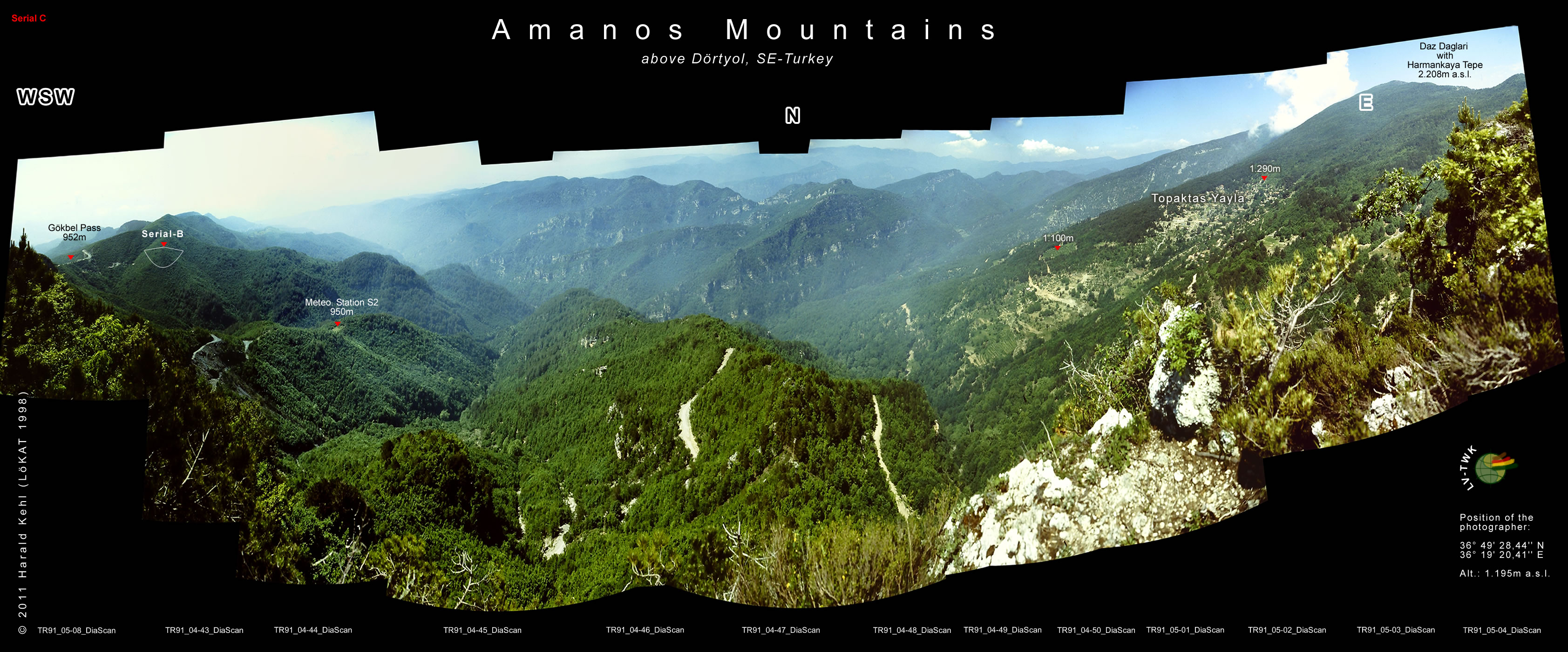
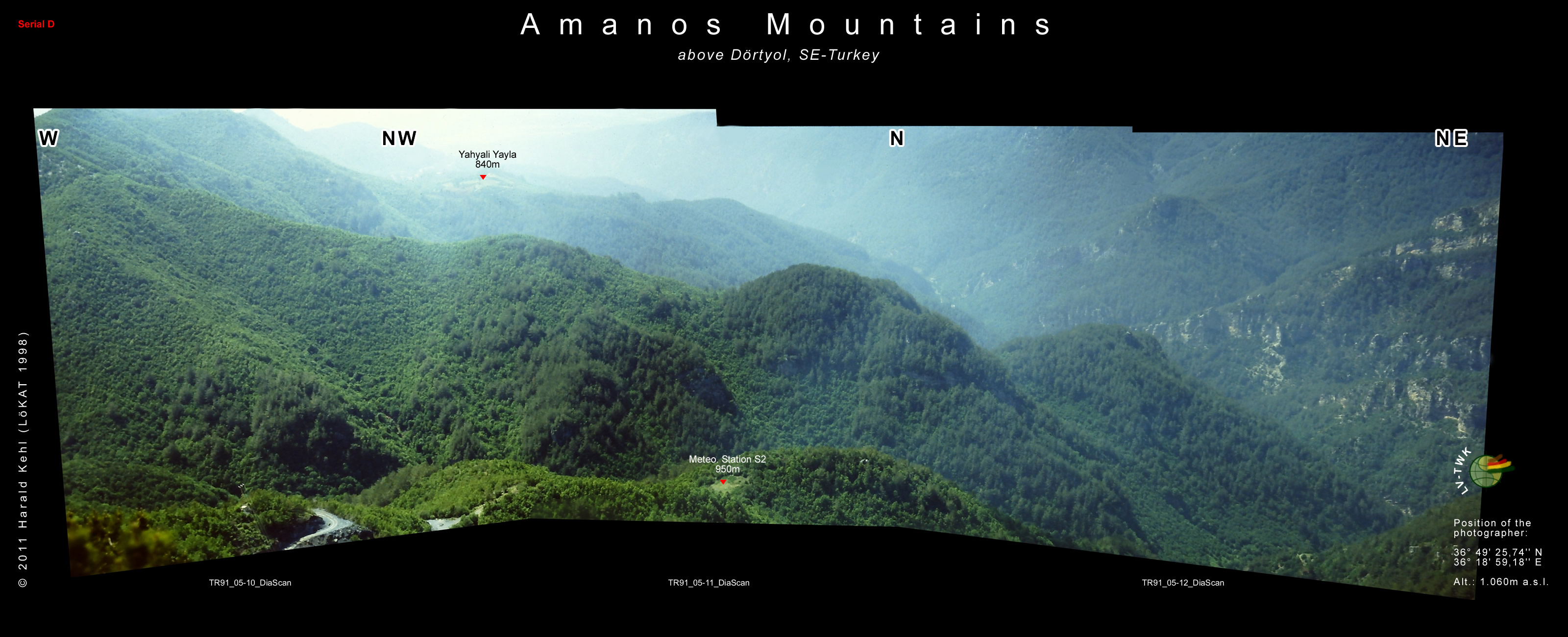
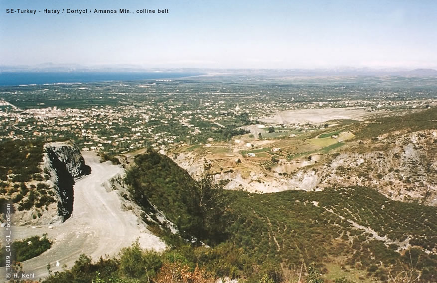
Impressive Mountain Panorama Views, Location of Photographer explained:
     
Fig. C6-16/04:
Amanos Mtn. Foothills, Colline and Middle Montane Belt east of Dörtyol.


Altitude (a.s.l.):  
50 - 700m  
   
  Remarks:
Author, composition of 5 photos (3.500x885 Pix.), jpg, 728KB, Series A-2.

Colline to middle montane belt with Pinus brutia forestation, and macchia as undergrowth, with patches of deciduous trees in the lower montane area.
Click the Thumbnail
       
       
Fig. C6-16/05:
Middle Montane Belt: Gökbel Pass / Saddle & location of the 2. Meteo. Station - S2 / 950m.
 
 
Altitude (a.s.l.):  
500 - 1.200m  
   
  Remarks:
Author, composition of 5 photos (3.200x1.100 Pix.), jpg, 541KB, Series B.

Middle montane belt with a deciduous forest and few patches of Pinus brutia, cf. TEMap 4 "Vegetation Units", with Quercus cerris - Carpinus orientalis, and Laurus nobilis - Tilia argentea.
Click the Thumbnail
       
       
Fig. C6-16/06:
Middle Montane Belt: Gökbel Pass, Meteo. Station S2 with Topaktaş and Daz Daǵları in the Background.
 
 
Altitude (a.s.l.):  
950 - 2.100m  
   
  Remarks:
Author, composition of 13 photos (3.367x1.400 Pix.), jpg, 926KB, Series C.

Middle montane belt with a deciduous forest in spring with few patches of Pinus brutia, cf. TEMap 4 "Vegetation Units", with Quercus cerris - Carpinus orientalis, and Laurus nobilis - Tilia argentea and Fagus sylvatica ssp. - Pinus nigra ssp.
Click the Thumbnail
       
       
Fig. C6-16/07:
Middle Montane Belt dominated by a deciduous forest, with Meteo. Station S2 with large Pinus brutia areas on ridges.
 
 
Altitude (a.s.l.):  
500 - 1.100m  
   
  Remarks:
Author, composition of 3 photos (3.200x1.300 Pix.), jpg, 587KB, Series D.

Middle montane belt with a deciduous forest with large areas of Pinus brutia, cf. TEMap 4 "Vegetation Units", with Quercus cerris - Carpinus orientalis, and Laurus nobilis - Tilia argentea. and Pinus brutia.
Click the Thumbnail
       
       
Fig. C6-16/08:
Middle Montane Belt dominated by a deciduous forest, with Meteo. Station S2 with few Pinus brutia patches on ridges.
 
 
Altitude (a.s.l.):  
950 - 2.100m  
   
  Remarks:
Author, composition of 9 photos (3.300x1.500 Pix.), jpg, 1.200KB, Series E.

Middle montane belt with a deciduous forest with few patches of Pinus brutia, cf. TEMap 4 "Vegetation Units", with Quercus cerris - Carpinus orientalis, and Laurus nobilis - Tilia argentea. and Pinus brutia.
Click the Thumbnail
 
 
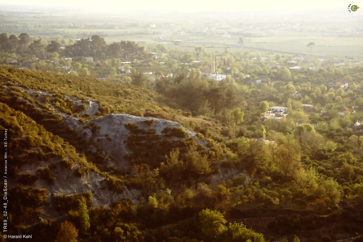
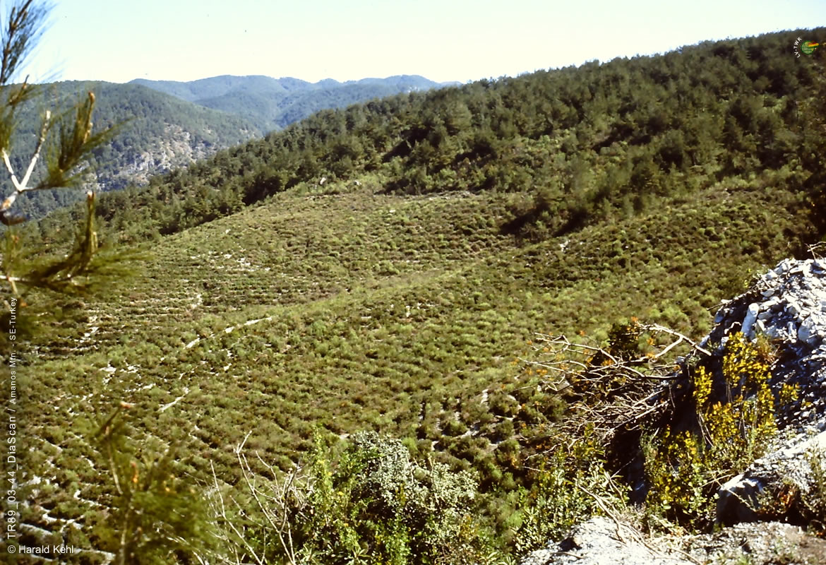
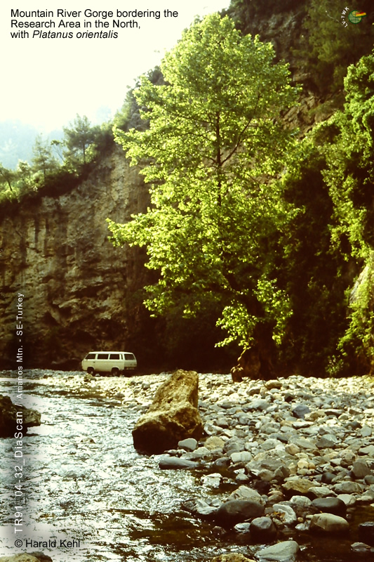
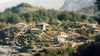
Yaylas and unique landscapes distinctive for the Research Area:
     
Fig. C6-16/09:
Coastal plain and colline belt (SE-Turkey / Amanos Mtns. / Amanos Daǵları) above Dörtyol.


Altitude (a.s.l.):  
30 - 250m  
   
  Remarks:
Author, western exposition

Colline belt (soft serpentinite, strongly eroded) with Pinus brutia afforestation, mixed with macchia elements (Cistus, Myrtus, Pistacia, Cotinus, and Quercus infectoria etc.). Coastal plain with Dörtyol in the background.
Click the Thumbnail
       
     
Fig. C6-16/10:
Gulf of Iskenderun, coastal plain and colline belt (SE-Turkey / Amanos Mtns. / Amanos Daǵları) above Dörtyol.
 
 
Altitude (a.s.l.):  
0 - 250m  
   
  Remarks:
Author, NW exposition

Colline belt (soft serpentinite, strongly eroded) with Pinus brutia afforestation, mixed with macchia elements (Cistus, Myrtus, Pistacia, Cotinus, and Quercus infectoria etc.). Coastal plain with Dörtyol and the Gulf of Iskenderun in the background.
Click the Thumbnail
       
     
Fig. C6-16/11:
Colline belt (SE-Turkey / Amanos Mtns. / Amanos Daǵları) above Dörtyol.


Altitude (a.s.l.):  
around 150m  
   
  Remarks:
Author, western exposition

Colline belt (soft serpentinite, strongly eroded) with Pinus brutia afforestation, mixed with macchia elements (Cistus, Myrtus, Pistacia, Cotinus, and Quercus infectoria etc.).
Click the Thumbnail
       
     
Fig. C6-16/12:
Mountain river gorge (SE-Turkey / Amanos Mtns. / Amanos Daǵları) above Dörtyol.


Altitude (a.s.l.):  
around 100m  
   
  Remarks:
Author

Mountain river gorge with steep slopes north of the Research Area with Platanus orientalis.
Click the Thumbnail
       
     
Fig. C6-16/13:
Çökek Yayla (SE-Turkey / Amanos Mtns. / Amanos Daǵları) above Dörtyol.


Altitude (a.s.l.):  
around 570m  
   
  Remarks:
Author

Lower montane belt with Pinus brutia (dominant) and large areas of a deciduous mixed forest with Carpinus orientalis, Quercus cerris and patches of Cornus mas.
Click the Thumbnail
       
     
Fig. C6-16/14:
Yahyalı Yayla - A (SE-Turkey / Amanos Mtns. / Amanos Daǵları) above Dörtyol.


Altitude (a.s.l.):  
around 850m  
   
  Remarks:
Author

Yahyalı Yayla between Cökek Y. and Topaktaş Y. Lower to middle montane belt with a mixed forest of Carpinus orientalis, Quercus cerris and fields.
Click the Thumbnail
 
Fig. C6-16/15:
Yahyalı Yayla - B (SE-Turkey / Amanos Mtns. / Amanos Daǵları) above Dörtyol.


Altitude (a.s.l.):  
around 850m  
   
  Remarks:
Author, jpg, 158KB.

Lower to middle montane belt with a mixed forest of Carpinus orientalis, Quercus cerris and fields.
Click the Thumbnail
       
     
Fig. C6-16/16:
Gökbel Pass and Yayla - A (SE-Turkey / Amanos Mtns. / Amanos Daǵları) above Dörtyol.


Altitude (a.s.l.):  
950 - 980m  
   
  Remarks:
Author, jpg, 203KB, southern exposition.

Gökbel (cf. Panorama Series B): Between Yahyalı Yayla and Topaktaş Yayla. Middle montane belt with a mixed forest of Carpinus orientalis, Quercus cerris, Cornus mas / sanguinea, Fraxinus ornus, Laurus nobilis (northern slopes), and degraded forest areas with Quercus coccifera and Phlomis viscosa (southern slopes).
Click the Thumbnail
       
     
Fig. C6-16/17:
Gökbel Pass and Yayla - B (SE-Turkey / Amanos Mtns. / Amanos Daǵları) above Dörtyol.


Altitude (a.s.l.):  
950 - 980m  
   
  Remarks:
Author, jpg, 318KB, southern exposition.

Gökbel (cf. Panorama Series B): Between Yahyalı Yayla and Topaktaş Yayla. Middle montane belt with a mixed forest of Carpinus orientalis, Quercus cerris, Cornus mas / sanguinea, Fraxinus ornus, Laurus nobilis (northern slopes), and degraded forest areas with Pinus brutia, Quercus coccifera and Phlomis viscosa (southern slopes).
Click the Thumbnail
       
     
Fig. C6-16/18:
Gökbel Pass and Yayla - C (SE-Turkey / Amanos Mtns. / Amanos Daǵları) above Dörtyol.


Altitude (a.s.l.):  
950 - 980m  
   
  Remarks:

Author, jpg, 235KB, eastern exposition.

Gökbel (cf. Panorama Series B): Between Yahyalı Yayla and Topaktaş Yayla. Middle montane belt with a mixed forest of Pinus brutia, Carpinus orientalis, Quercus cerris, Cornus mas, Fraxinus ornus (eastern slopes).

Click the Thumbnail
       
     
Fig. C6-16/19:
Gökbel Pass and Yayla - D (SE-Turkey / Amanos Mtns. / Amanos Daǵları) above Dörtyol.


Altitude (a.s.l.):  
950 - 980m  
   
  Remarks:

Author, jpg, 235KB, northern exposition.

Gökbel (cf. Panorama Series B): Between Yahyalı Yayla and Topaktaş Yayla. Middle montane belt with a mixed forest of Carpinus orientalis, Quercus cerris, Cornus mas / sanguinea, Fraxinus ornus, Laurus nobilis (northern slopes).

Click the Thumbnail
       
     
Fig. C6-16/20:
Gökbel Pass and Yayla - E (SE-Turkey / Amanos Mtns. / Amanos Daǵları) above Dörtyol.
Goats in action.
 
 
Altitude (a.s.l.):  
950 - 980m  
   
  Remarks:

Author, jpg, 180KB, NW exposition.

Near Gökbel. Between Yahyalı Yayla and Topaktaş Yayla. Middle montane belt with grazing goats.

Click the Thumbnail
       
     
Fig. C6-16/21:
Gökbel Pass and Yayla - F (SE-Turkey / Amanos Mtns. / Amanos Daǵları) above Dörtyol.
 
 
Altitude (a.s.l.):  
850 - 1.000m  
   
  Remarks:

Author, jpg, 322KB, NW exposition.

Gökbel (cf. Panorama Series B): Between Yahyalı Yayla and Topaktaş Yayla. Middle montane belt. Traditional simple shed for Goats.

Click the Thumbnail
       
     
Fig. C6-16/22:
Between Gökbel Pass and Topaktaş Yayla (SE-Turkey / Amanos Mtns. / Amanos Daǵları) above Dörtyol.
Road construction
 
 
Altitude (a.s.l.):  
1.080m  
   
  Remarks:

Author, jpg, 237 KB, W exposition.

Between Yahyalı Yayla and Topaktaş Yayla. Middle montane belt. Road construction and Vegetation degradation.

Click the Thumbnail
       
     
Fig. C6-16/23:
Topaktaş Yayla - A with cloudbank formation (SE-Turkey / Amanos Daǵları, above Dörtyol)
 
 
Altitude (a.s.l.):  
around 1.200m  
   
  Remarks:
Author

Middle to upper montane belt with a Fagus sylvatica ssp. orientalis forest with patches of Pinus nigra ssp. pallasiana and fields.
Click the Thumbnail
Topaktas Yayla
       
     
Fig. C6-16/24:
Topaktaş Yayla - B (SE-Turkey / Amanos Daǵları, above Dörtyol)
 
 
Altitude (a.s.l.):  
800 - 1.350m  
   
  Remarks:
Author, jpg, 237 KB, W exposition.

Middle to upper montane belt with a Fagus sylvatica ssp. orientalis forest with patches of Pinus nigra ssp. pallasiana, and Quercus cerris, Fraxinus ornus on ridges.
Click the Thumbnail
       
     
Fig. C6-16/25:
Topaktaş Yayla - C (SE-Turkey / Amanos Daǵları, above Dörtyol)
 
 
Altitude (a.s.l.):  
800 - 1.350m  
   
  Remarks:
Author, jpg, 200 KB, W exposition.

Middle to upper montane belt with the Yayla settlement.
Click the Thumbnail
       
     
Fig. C6-16/26:
Between Topaktaş Yayla and Karamezrea Yayla (SE-Turkey / Amanos Daǵları, above Dörtyol), Beech Forest.
 
 
Altitude (a.s.l.):  
1.650m  
   
  Remarks:
Author, jpg, 289 KB, W exposition.

Upper montane belt with a large continuous Fagus sylvatica ssp. orientalis forest, interspersed by small patches of Pinus nigra ssp. pallasiana.
Click the Thumbnail
       
     
Fig. C6-16/27:
Near Karamezrea Yayla (SE-Turkey / Amanos Daǵları, above Dörtyol), Mountain Streamlet.
 
 
Altitude (a.s.l.):  
1.750m  
   
  Remarks:
Author, jpg, 236 KB, W exposition.

Upper montane belt with Fagus sylvatica ssp. orientalis forest near Karamezrea Yayla (1.800-1.880m). Small alpine stream with pure and clean water.
Click the Thumbnail
       
     
Fig. C6-16/28:
Middle montane belt near Gökbel Yayla (SE-Turkey / Amanos Daǵları, above Dörtyol), Mountain Streamlet polluted by plastic waste and rubbish.
 
 
Altitude (a.s.l.):  
850m  
   
  Remarks:
Author, jpg, 289 KB, W exposition.

Middle montane belt with mixed deciduous forest of Carpinus orientalis, Laurus nobilis, Fagus sylvatica ssp. orientalis near Gökbel Yayla. Small mountaine stream polluted by plastic waste and rubbish.
Click the Thumbnail
       
     
Fig. C6-16/29:
Between Topaktaş Yayla and Karamezrea Yayla (SE-Turkey / Amanos Daǵları, above Dörtyol), degraded Beech Forest.
 
 
Altitude (a.s.l.):  
ca. 1.550m  
   
  Remarks:
Author, N exposition.

Upper montane belt with Fagus sylvatica ssp. orientalis forest between Topaktas and Karamezrea Yayla, ca. 1.550m. Degraded Beech Forest with Abies cilicica in the background.
Click the Thumbnail
       
     
Fig. C6-16/30:
Timber harvesting (Fagus sylvatica ssp.) between Topaktaş Yayla and Karamezrea Yayla (Amanos Daǵları, above Dörtyol).
 
 
Altitude (a.s.l.):  
ca. 1.750m  
   
  Remarks:
Author, jpg, 313KB, E exposition.

Upper montane belt with Fagus sylvatica ssp. orientalis forest between Topaktas and Karamezrea Yayla. Timber harvesting.
Click the Thumbnail
       
     
Fig. C6-16/31:
Beech forest - A near Karamezrea Yayla (Amanos Daǵları, above Dörtyol).
 
 
Altitude (a.s.l.):  
ca. 1.850m  
   
  Remarks:
Author, jpg, 366KB, NE exposition.

Upper montane belt with Fagus sylvatica ssp. orientalis forest near Karamezrea Yayla. Old beech trees are very rare.
Click the Thumbnail
       
     
Fig. C6-16/32:
Beech forest - B near timber line (Amanos Daǵları, above Dörtyol).
 
 
Altitude (a.s.l.):  
ca. 2.050m  
   
  Remarks:
Author, jpg, 313KB, E exposition.

Upper montane belt near timberline with Fagus sylvatica ssp. orientalis forest above Karamezrea Yayla. Beech trees are often damaged by "Frosttrocknis" near the timber line. The closed forest shows no undergrowth.
Click the Thumbnail
       
     
Fig. C6-16/33:
Timber line with Fagus sylvatica ssp. orientalis and patches or single Abies cilicica (Amanos Daǵları, Daz Daǵları above Dörtyol).
 
 
Altitude (a.s.l.):  
2.030 - 2.070m  
   
  Remarks:
Author, jpg, 327KB, NE exposition.

Timberline with Fagus sylvatica ssp. orientalis forest (with "Kniewuchs") above Karamezrea Yayla with Abies cilicica in the background.
Click the Thumbnail
       
     
Fig. C6-16/34:
Degraded remnants of Fagus sylvatica ssp. orientalis patches near timberline (Amanos Daǵları, Daz Daǵları above Dörtyol).
 
 
Altitude (a.s.l.):  
2.070m  
   
  Remarks:
Author, jpg, 271KB, N exposition.

Remnants of the old timberline with the Fagus sylvatica ssp. orientalis forest in late April 1989.
Click the Thumbnail
       
     
Fig. C6-16/35:
Alpine meadow with Astragalus, Limonium and Marrubium near timberline (Amanos Daǵları, Daz Daǵları above Dörtyol).
 
 
Altitude (a.s.l.):  
2.150m  
   
  Remarks:
Author, jpg, 271KB, N exposition, early autumn 1991.

Alpine meadow above timberline with Alopecurus gerardii ssp. (dominant), Marrubium globosum, Vincetoxicum tmoleum, and different species of Astragalus and Limonium.
Click the Thumbnail
       
     
Fig. C6-16/36:
Near timberline with only few Cedrus libani (Amanos Daǵları, Daz Daǵları above Dörtyol).
 
 
Altitude (a.s.l.):  
2.050m  
   
  Remarks:
Author, jpg, 271KB, S exposition, late spring 1989.

Alpine meadow near timberline with Cedrus libani, often strongly demolished.
Click the Thumbnail
       
     
Fig. C6-16/37:
Near timberline with Abies cilicica (Amanos Daǵları, Daz Daǵları above Dörtyol).
 
 
Altitude (a.s.l.):  
2.050m  
   
  Remarks:
Author, jpg, 289KB, NW exposition, early autumn 1991.

Near timberline with Abies cilicica, often growing on steep slopes.
Click the Thumbnail
       
     
Fig. C6-16/38:
Steep NW exposed slopes near timberline with Abies cilicica (Amanos Daǵları, Daz Daǵları above Dörtyol).
 
 
Altitude (a.s.l.):  
2.050m  
   
  Remarks:
Author, jpg, 289KB, NW exposition, late spring 1989.

Abies cilicica, often growing on steep slopes.
Click the Thumbnail
       
     
Fig. C6-16/39:
Cloud bank formation above Topaktas Yayla and timberline near weather station S4 (Amanos Daǵları, Daz Daǵları above Dörtyol).
 
 
Altitude (a.s.l.):  
2.050m  
   
  Remarks:
Author, jpg, 128KB, W exposition, late spring 1989.

Cloudbank formation with timberline (Fagus sylvatica ssp. orientalis) near S4 .
Click the Thumbnail
       
     
Fig. C6-16/40:
Weather station S4 of the Research Project LöKAT above timberline (Amanos Daǵları, Daz Daǵları above Dörtyol).
 
 
Altitude (a.s.l.):  
2.100m  
   
  Remarks:
Author, jpg, 146KB, W exposition.

Weather station S4 (of four installed stations) above timberline measuring 14 parameters. Weather Data Acquisition from 1989-1992 with CM 10 (21X) 'automatic weather stations' manufactured by CAMPBELL SCIENTIFIC Ltd.
Click the Thumbnail
       
     
Fig. C6-16/41:
Alpine meadow (Amanos Daǵları), above Osmaniye.
 
 
Altitude (a.s.l.):  
ca. 2.200m  
   
  Remarks:
Author, jpg, 146KB, N exposition.

Click the Thumbnail
       
     
Fig. C6-16/42:
Easterly foothills of the Amanos Mtns. below NE of Belen (Amanos Daǵları), with Quercus ithaburensis ssp. macrolepis.
 
 
Altitude (a.s.l.):  
ca. 150m  
   
  Remarks:
Author, jpg, 175KB, E exposition.

Single trees of Quercus ithaburensis ssp. growing in grain fields etc.
Click the Thumbnail
       
     
Fig. C6-16/43:
Westerly foothills of the Amanos Mtns. between Dörtyol and Erzin (Amanos Daǵları), with Quercus infectoria ssp. boisseri.
 
 
Altitude (a.s.l.):  
ca. 80m  
   
  Remarks:
Author, jpg, 102KB, W exposition.

Single trees of Quercus infectoria ssp. boisseri growing in grain fields etc. These trees are remnants of a Quercus infectoria ssp. boissieri forest.
Click the Thumbnail


back    
     
   
LV-TWK-Kehl
Copyright © Harald Kehl
Formerly TU-Berlin - Institut für Ökologie - Germany
sep-link
 
Seite empfehlen      print      Bookmark me