| |
|
|
| |
 |
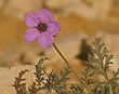
Runnel
vegetation in NW-Egypt, near Mersa Matruh, 2. shallow
escarpment: |
| |
|
| |
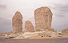
"Runnel
vegetation" of R a q a b e t E
l S i k k a |
| |
|
 |
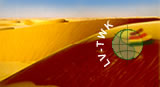
Satellite image of
the area under research |
|
Vegetation distribution
map |
|
Table with vegetation
units and included species of the units (incl. frequency
and coverage values) |
|
|
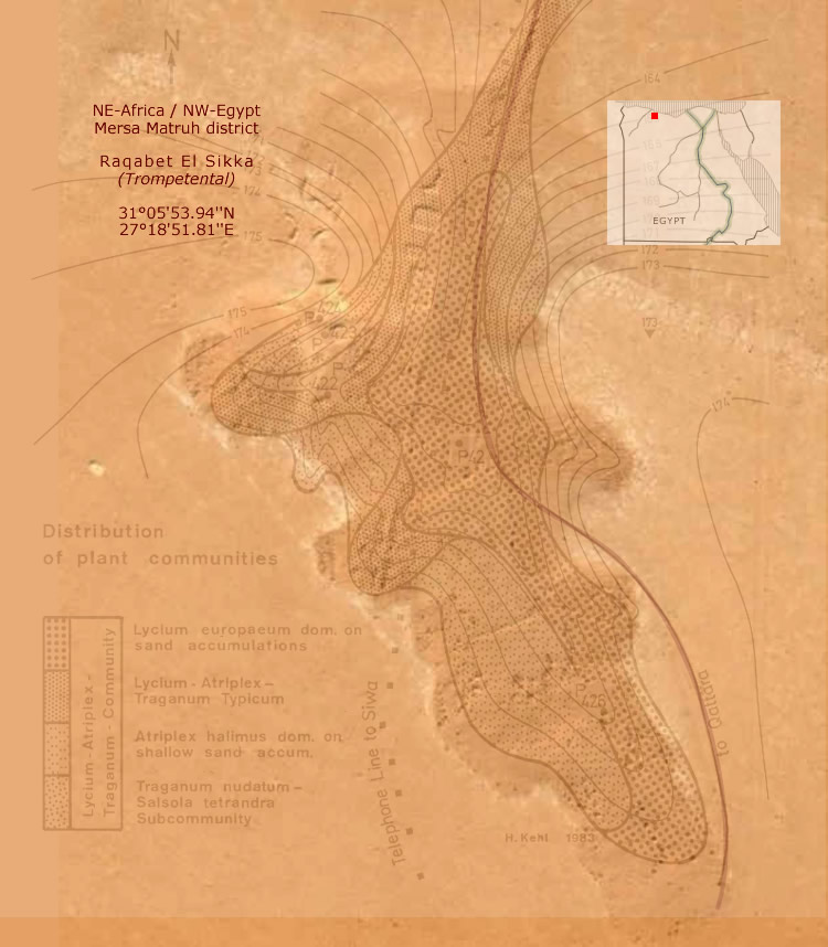
- Satellite
image of the area under research with the
idealized vegetation distribution map as a transparent
layer. Research are: NE-Africa, NW-Egypt, northern
edge of the Marmarica Plateau, 2nd shallow escarpment
with runnels and the beginning of several wadis,
ca. 29km SSE of Mersa Matruh, ca. 18km SW from
the coast. For co-ordinates compare the map
below!
|
 |
| |
|
|
 Abb.
/ Fig. D2-01/01 (above): Abb.
/ Fig. D2-01/01 (above):
Vegetation distribution map of the Raqabet El
Sikka runnel with zonal arrangement of vegetation
units (idealised contour lines). P42 to P426 are
soil profiles which will be not discussed in this
contribution. |
| |
|
| |
|
| |
|
 |
| |
|
|
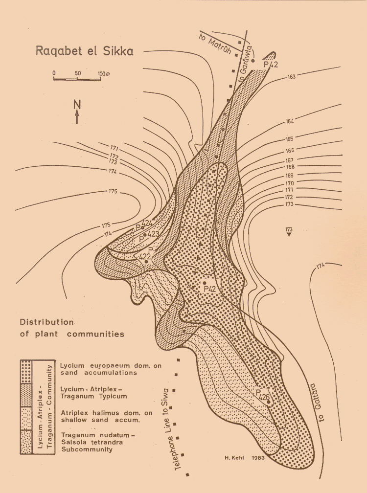
Abb.
/ Fig. D2-01/03 (above):
Distribution of Plant Communities - Raqabet el
Sikka. |
| |
|
| |
|
| |
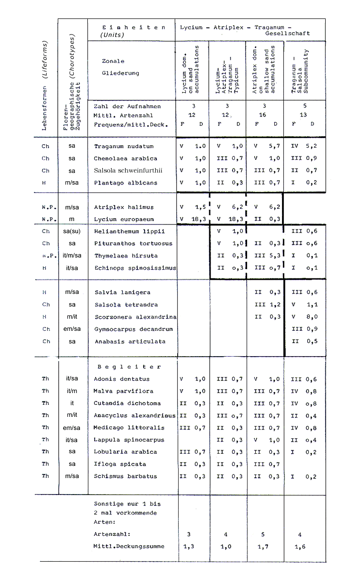
 Tab.
D2-01/01: Tab.
D2-01/01:
Zonal arrangement of
vegetation units, and species forming the units
of the Raqabet El Sikka runnel. Frequency and coverage
according to Braun-Blanquet. |
| |
|
 |
| |
|
| |
Abbreviations: |
| |
|
| |
Lifeforms:
- Th
= Therophytes, H = Hemi-Cryptophytes,
Ch = Chamaephytes, N-P = Nano-Phanerophytes
|
| |
Chorotypes:
- m
= Mediterranean, em = East-Mediterranean,
it = Irano-Turanian, sa = Saharo-Arabian,
su = Sudanian, m/it, m/sa,
sa/it etc. = bi- and pluri-regionals
|
| |
|
| |
|
 |
| |
|
| |
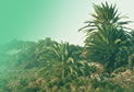
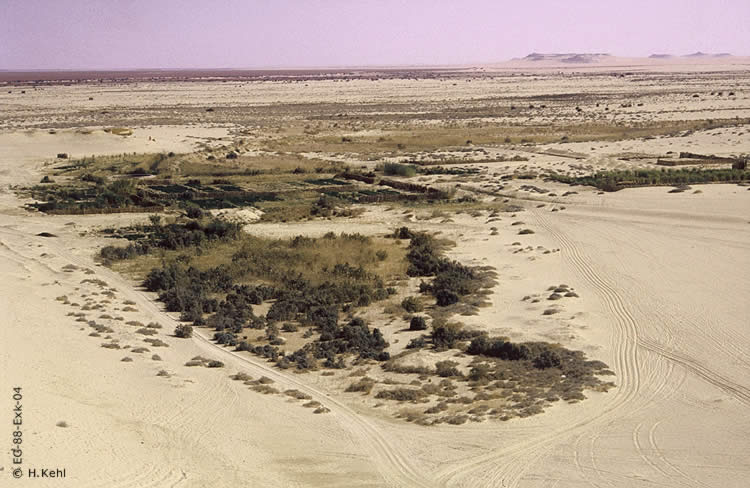
Abb.
/ Fig. D2-01/04 (above):
Typical
runnel vegetation near Mersa Matruh, northern edge
of the Marmarica Plateau, 2nd shallow escarpment.
It is not the same location as described above.
|
| |
|
| |
Further
information:
- Bornkamm,
R. & H. Kehl (1990) The
plant communities of the Western desert of Egypt.-
Phytocoenologia 19(2): 149-231.
- Kehl,
H. & R. Bornkamm (1988)
The change of soil-vegetation interrelation
with increasing aridity in the northern part
of Egypt.- International Conference on 'Plant
Growth, Drought and Salinity in the Arab Region',
Giza, Egypt, 3-7 December. More:
 Abstract
[date
of access: 08.05.04]
Abstract
[date
of access: 08.05.04]
- Kehl,
H., K. Stahr & J. Gauer (1984) Soil-Vegetation
Relationship of a small Catchment Area on the
Libyan Plateau in N.W. Egypt.- Berliner geowiss.
Abh. (A) 50: 303-324.
- Stahr,
K., R. Bornkamm, J. Gauer & H. Kehl (1985)
Veränderung von Böden und Vegetation
am Übergang von Halbwüste zur Vollwüste.-
Geoökodynamik 6: 99-120.
|
| |
|
 |
 |
 |
|
|

|
Copyright
© H. Kehl
ehemals TU-Berlin - Institut für Ökologie
|
| |
| |
| |
|
|
|