| Location: |
Lat.
/ Long.: |
Region: |
Detailled
investigations: |
| |
|
|
|
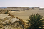
| Abu
Mukhaiyat |
30°41'16.80"N / 27°10'44.73"E |
NW-Egypt |
|
| Bahariya
Oasis |
28°15'11.94"N / 28°56'32.96"E |
C-Egypt |
|
| Dakhla
Oasis (Centre Mut) |
25°29'15.88"N / 28°58'58.04"E |
C-Egypt |
|
| Dungul
Wells |
23°26'05.50"N / 31°37'20.46"E |
S-Egypt |
|
| Farafra
Oasis |
27°03'27.63"N / 27°58'09.82"E |
C-Egypt |
|
| Girba
Oasis |
29°20'41.19"N / 25°21'00.77"E |
NW-Egypt |
|
|
|
|
|
| Kharga
Oasis |
25°26'25.86"N / 30°33'25.65"E |
C-Egypt |
|
| Kharga
Oasis - Bulaq |
25°12'03.18"N / 30°32'08.83"E |
C-Egypt |
|
| Kurkur
Oasis |
23°54'03.55"N / 32°19'05.02"E |
C-Egypt |
|
|
|
|
|
| Mersa
Matruh (MM) City |
31°21'17.96"N / 27°14'03.08"E |
NW-Egypt |
|
| MM
district: |
30°42'31.80"N
/ 27°15'16.09"E |
NW-Egypt |
Near
Abu Makhaiyat, 61km SE MM
"Würstchen-Plaja I" |
| MM
district: |
30°43'39.48"N / 26°36'14.21"E |
NW-Egypt |
MM
- Siwa 99,5km
"Würstchen-Plaja II" |
| MM
district: |
31°05'53.94"N
/ 27°18'51.81"E |
NW-Egypt |
Raqabet
El Sikka , 32km SE MM
"Trompetental" |
| MM
district: |
31°05'53.94"N
/ 27°18'51.81"E |
NW-Egypt |
"Scherental"
, 32km MM-Siwa |
| MM
district: |
30°10'50.33"N / 26°14'55.52"E |
NW-Egypt |
"Salvia-Plaja"
, 166km MM-Siwa |
| MM
district: |
30°21'21.98"N / 27°17'08.57"E |
NW-Egypt |
"Gips-Plaja"
, 20km N of QD |
| Nuweimisa |
28°42'07.98"N / 26°43'40.55"E |
NW-Egypt |
|
| Qara
Oasis |
29°36'55.39"N / 26°29'47.36"E |
NW-Egypt |
|
| Ras
El Qattara(h) |
30°10'40.74"N / 27°15'51.35"E |
NW-Egypt |
|
Sitra(h)
Oasis
|
28°42'43.42"N / 26°53'48.03"E |
NW-Egypt |
|
|
|
|
|
Siwa
Oasis
|
29°12'10.56"N / 25°31'03.59"E |
NW-Egypt |
|
| |
|
|
|
| |
|
|
|
| |
|
|
|